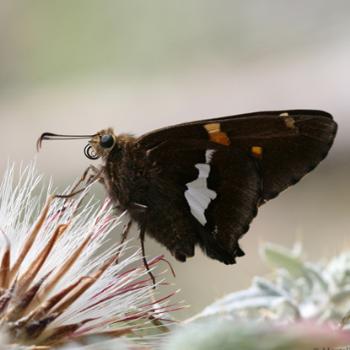
The Colonel Devin Trail about 14 miles Northeast of Payson.

This is an excellent area to check out beginning in April till mid September. The trailhead sits at 6000 feet elevation and the trail goes up from there. When the weather gets warmer, the flowers start to bloom higher and higher in elevation. Butterflies follow this nectar flow “up the trail”. An abundant plant along the trail: Bergamot attracts lots of Fritillaries. Butterfly Weed and Arizona Thistle are also popular amongst the nectaring butterflies. Other butterflies (like Blues and Duskywings) are more interested in mudpuddling at one of the three springs. Yet another group of butterflies like California Sister, Satyr Comma and Weidemeyer’s Admiral are mostly found perched on trees. The trail is moderately steep in places.
Details to get to the trailhead: Drive to Payson, go straight at the hwy 260 intersection. After 3/4 mile turn right onto Houston Mesa Road. After about 8 miles you get to a stop sign. Here you turn left onto Control Road. The road now turns into a dirt road. After about 1 mile turn right towards Shadow Rim Camp and Washington Park Trailhead. Follow this road up for about 5.5 miles until the right turn-off to the Washington Park Trailhead (marked). Immediately turn left (signs again) and in half a mile you will find the trailhead well marked on the Northeast side of the parking lot.
|